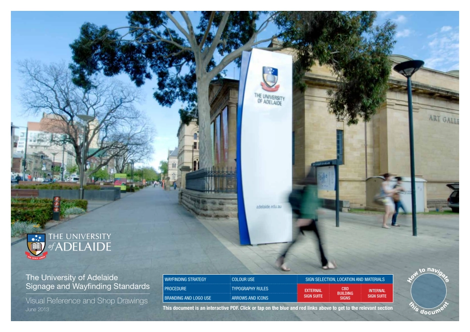
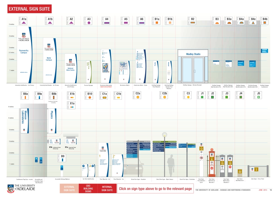
The University of AdelaideSignage and Wayfinding StandardsVisual Reference and Shop Drawings June 2013WAYFINDING STRATEGYCOLOUR USESIGN SELECTION, LOCATION AND MATERIALSPROCEDURETYPOGRAPHY RULESEXTERNALSIGN SUITECBD BUILDINGSIGNSINTERNALSIGN SUITEBRANDING AND LOGO USEARROWS AND ICONSThis document is an interactive PDF. Click or tap on the blue and red links above to get to the relevant sectionTHE UNIVERSITY OF ADELAIDE - SIGNAGE AND WAYFINDING STANDARDSJUNE 20132WAYFINDING STRATEGYThe University of Adelaide is a very complex site. Research on complex sites suggests the most effective system is to use a ‘map based’ approach, as it would be nearly impossible to direct users around with individual blade signs.There are multiple stages to any wayfinding approach, this document outlines the stages proposed for North Terrace on TABLE 1 on the following page. In brief: 1. It is imperative users can identify the University Campus boundaries 2. Users must be able to find the appropriate Gate Number for entering the site. 3. Once entered, users should be able to locate a map based directory to be able to find the appropriate ‘building name’ and location and point them in the general direction of their destination. 4. As most people generally can’t remember maps, sign posts have been used as ‘prompts’ to pin-point which buildings are located on a particular ‘street’ and remind users when to turn. 5. Clear building identification signs should be located above/next to main building entrances. 6. Once users are inside a particular building the foyer directory will be able to provide specific location information for the service, facility etc. they seek. These Standards aim to link all signage elements using consistent colours and materials to identify the wayfinding system. A colour coding system has been used to delineate between buildings, major destinations, open spaces, and security. This colour code helps to break-up large quantities of information, and provides a hierarchy/structure to the wayfinding. All existing signage should be removed so as not to dilute the new system or provide contradictory information.WAYFINDING STRATEGY - WAITE & ROSEWORTHYThe Waite and Roseworthy Campuses are wide spread, sprawling facilities and therefore would primarily be accessed by vehicles. The Waite campus sits either side of Waite Road which has various ‘gates’ or side streets that veer off towards the many buildings located on the University land. Given the number of buildings, standard roadside blade signs were deemed to be too small and inflexible, therefore a larger style floor mounted pylon sign was chosen. This style accommodates more information at larger sizes, such as gate numbers which were seen as an easy, memorable wayfinding device, especially from within the car.Campus maps have been introduced at some carparks to assist regular users. Ther...